In 2005, we set out to map the world. Since then we’ve pushed the limits of
Google Maps is turning 15! Celebrate with a new look and features
Made for you, on the go
We’re constantly evolving to help you get around—no matter how you choose to travel. Our new transit features in the Google Maps app help you stay informed when you’re taking public transportation.
Last year, we introduced crowdedness predictions to help you see how crowded your bus, train or subway is likely to be based on past rides. To help you plan your travels, we’re adding new insights about your route from past riders, so you’ll be able to see important details, such as:
- Temperature: For a more comfortable ride, check in advance if the temperature is considered by past riders as on the colder or warmer side.
- Accessibility: If you have special needs or require additional support, you can identify public transit lines with staffed assistance, accessible entrance and seating, accessible stop-button or hi-visible LED.
- Women’s Section: In regions where transit systems have designated women’s sections or carriages, we’ll help surface this information along with whether other passengers abide by it.
- Security Onboard: Feel safer knowing if security monitoring is on board—whether that’s with a security guard present, installed security cameras or an available helpline.
- Number of carriages available: In Japan only, you can pick a route based on the number of carriages so that it increases your chances of getting a seat.
These useful bits of information come from past riders who’ve shared their experiences and will appear alongside public transit routes when available. To help future riders, you can answer a short survey within Google Maps about your experience on recent trips. We’ll start rolling this out globally in March, with availability varying by region and municipal transportation agency.
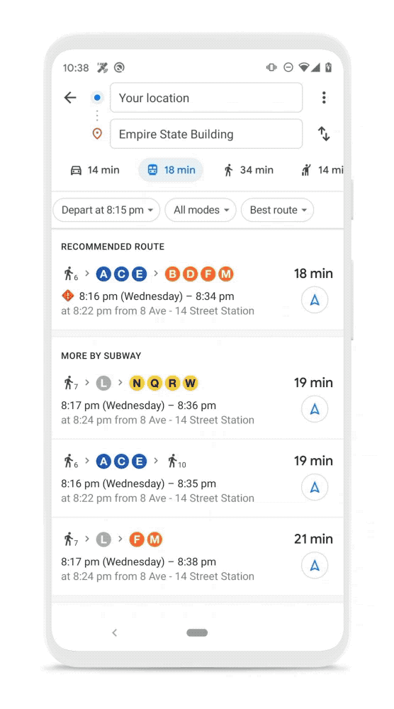
New trip attributes help you make informed decisions about your travel plans.
A sense of direction
Last year, we introduced Live View to help you quickly decide which way to go when you start a walking route with Google Maps. By combining Street View’s real-world imagery, machine learning and smartphone sensors, Live View in Google Maps shows you your surroundings with the directions overlaid in augmented reality.
Over the coming months, we’ll be expanding Live View and testing new capabilities, starting with better assistance whenever you’re searching for a place. You’ll be able to quickly see how far away and in which direction a place is.
Live View will soon help you get oriented in the right direction in new ways.
A big thank you to everyone for placing your trust in us and for being with us on this wild ride over the last 15 years. See you out there on the journey!